
Ski Lessons by SkiBro
BOOK NOW
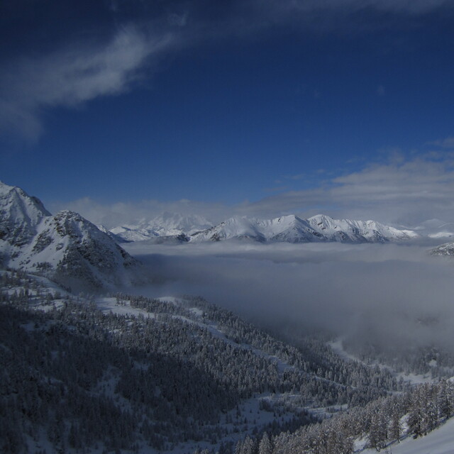
Ski lessons in Montgenèvre (Vialattea)
Book now
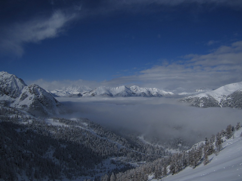


Montgenèvre (Vialattea) Weather (Next 3 days): The snow forecast for Montgenèvre (Vialattea) is: Una leggera copertura di neve nuova, che ancora cade Giovedì pomeriggio. Condizioni di gelo e disgelo (max 2°C Venerdì pomeriggio, min -7°C Giovedì notte). Vento sarà generalmente leggero.
Montgenèvre (Vialattea) Weather (Days 4-6): Una pesante caduta di neve, più pesante durante Lunedì notte. Le temperature saranno sotto lo zero (max 0°C Mercoledì mattina, min -6°C Domenica notte). Vento sarà generalmente leggero.
| Altezza | Spessore della neve | Temp. (°C) | Vento (km/h) | Meteo | ||
|---|---|---|---|---|---|---|
| Cima: | -10 | |||||
| Media: | -5 | |||||
| Fondo: | 1 |
Gli ultimi report della neve vicino a Montgenèvre (Vialattea):
For Les Menuires: No wind today. Feeling cold here today. New snow is ankle depth. There are some open lifts. Excellent piste conditions. Fresh snow off-piste. da Les Menuires
Snow falling in Les Menuires. da Les Menuires
There is heavy snow falling at Montgenèvre (Vialattea). da Montgenèvre (Vialattea)
Snow falling in Val Thorens. da Val Thorens

Thu 18 | Friday 19 | Saturday 20 | Sunday 21 | Monday 22 | Tuesday 23 | Wednesday 24 | ||||||||||||||
PM | notte | AM | PM | notte | AM | PM | notte | AM | PM | notte | AM | PM | notte | AM | PM | notte | AM | PM | notte | |
nevi cata leggera | rovescio di neve | limpido | poche nuvole | rovescio di neve | limpido | poche nuvole | limpido | poche nuvole | nevi cata leggera | nevi cata mod. | nevi cata leggera | nevi cata leggera | nevi cata mod. | nevi cata leggera | nevi cata leggera | nevi cata leggera | rovescio di neve | rovescio di neve | nevi cata leggera | |
km/h | ||||||||||||||||||||
Snow map |  |  |  |  |  |  |  | |||||||||||||
cm | 3 | 1.0 | — | — | 1.0 | — | — | — | — | 1.0 | 6 | 4 | 2.0 | 9 | 3 | 1.0 | 4 | — | 1.0 | — |
mm | — | — | — | — | — | — | — | — | — | — | — | — | — | — | — | — | — | — | — | — |
max°C | -4 | -5 | -1 | 2 | 0 | -3 | -2 | -4 | -4 | -2 | -4 | -5 | -4 | -5 | -3 | -2 | -3 | 0 | 0 | -3 |
min°C | -5 | -7 | -4 | 1 | -3 | -5 | -2 | -6 | -6 | -3 | -6 | -6 | -4 | -5 | -5 | -2 | -4 | -3 | -1 | -5 |
chill°C | -10 | -10 | -7 | -2 | -7 | -10 | -6 | -9 | -9 | -7 | -9 | -10 | -8 | -9 | -8 | -4 | -8 | -6 | -4 | -8 |
Umido.% | 81 | 67 | 27 | 65 | 93 | 58 | 62 | 71 | 59 | 75 | 86 | 83 | 87 | 95 | 86 | 81 | 95 | 81 | 82 | 69 |
Zero termico (m) | 1350 | 700 | 1950 | 2250 | 1550 | 1600 | 1750 | 1000 | 1550 | 1700 | 1150 | 1400 | 1450 | 1250 | 1600 | 1750 | 1350 | 1950 | 1900 | 900 |
— | — | 6:41 | — | — | 6:39 | — | — | 6:37 | — | — | 6:35 | — | — | 6:33 | — | — | 6:31 | — | — | |
— | 8:22 | — | — | 8:22 | — | — | 8:24 | — | — | 8:25 | — | — | 8:27 | — | — | 8:28 | — | — | 8:30 | |
Una leggera copertura di neve nuova, che ancora cade Giovedì pomeriggio. Condizioni di gelo e disgelo (max 2°C Venerdì pomeriggio, min -7°C Giovedì notte). Vento sarà generalmente leggero.
Una pesante caduta di neve, più pesante durante Lunedì notte. Le temperature saranno sotto lo zero (max 0°C Mercoledì mattina, min -6°C Domenica notte). Vento sarà generalmente leggero.
Gli ultimi report della neve vicino a Montgenèvre (Vialattea):
For Les Menuires: No wind today. Feeling cold here today. New snow is ankle depth. There are some open lifts. Excellent piste conditions. Fresh snow off-piste. da Les Menuires
Snow falling in Les Menuires. da Les Menuires
There is heavy snow falling at Montgenèvre (Vialattea). da Montgenèvre (Vialattea)
Snow falling in Val Thorens. da Val Thorens
| La profondità maggiore della neve é: | — |
|---|---|
| La profondità minore della neve é: | — |
| Fresh snowfall depth: | — |
| Quando ha nevicato l'ultima volta? | 10 Apr 2024 |
0.1 | Giorni neve fresca Neve fresca, prevalentemente soleggiato, vento debole. |
|---|---|
0.4 | Giorni neve fresca Fresh snow, limited sun, any wind. |
0.4 | Giorni Bluebird Neve media, prevalentemente soleggiato, vento debole. |
La tabella sopra da le previsioni meteo per Montgenèvre (Vialattea) a specifiche altezze 2015 m. I nostri sofisticati modelli meteo ci consentono di fornire previsioni neve per la vetta, l'area intermedia e a valle delle stazioni sciistiche di Montgenèvre (Vialattea). Per accedere alle previsioni meteo ad altre altezze, per spostarti usa tab sopra la tabella. Per una visione meteo piu' ampia , controlla la mappa meteo di France.
Clicca qui per leggere ulteriori informazioni sullo zero termico e il nostro sistema di prevedere le temperature.
Il nome della localita' è scritto anche come Montgenevre (Via Lattea).
Complessivamente 4.1 Basato su 17 voti e 34 recensioni
Montgenevre is a little gem. Usually great snow, no crowds and plenty of variety We have skied every year and sometimes twice, since 2006. Linked access to the Via Latea is a bonus. Again, booked to go in January: all fingers crossed that France will let us in! We are fully jabbed and healthy!
deborah scollan da United Kingdom scrive:
Montgenevre is a little gem. Usually great snow, no crowds and plenty of variety We have skied every year and sometimes twice, since 2006. Linked access to the Via Latea is a bonus. Again, booked to go in January: all fingers crossed that France will let us in! We are fully jabbed and healthy!
Leggi 33 più recensioni di Montgenèvre (Vialattea) o invia la tua
Il Montgenèvre (Vialattea) widget meteo qui sotto è disponibile per essere incorporato su siti Web esterni a titolo gratuito. Esso fornisce un riepilogo giornaliero delle nostre Montgenèvre (Vialattea) previsioni meteo neve e dati meteo. Basta andare alla pagina di configurazione e seguire 3 semplici passi per prendere il codice html personalizzato ed incollarlo nel tuo sito. È possibile scegliere l'elevazione di previsione di neve (vetta, metà o piede della montagna) e l'unità metrica/imperiale per le previsioni meteo neve adeguata al proprio sito Web Clicca qui per ottenere il codice
Guarda previsioni meteo neve dettagliate per Montgenèvre (Vialattea) a:
snow-forecast.com


 Nearest