
Ski Lessons by SkiBro
BOOK NOW
Ski lessons in Igls
Book now
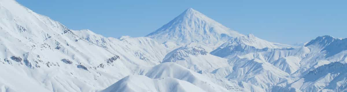


Igls Weather (Next 3 days): The snow forecast for Igls is: Una leggera copertura di neve nuova, che ancora cade Mercoledì notte. Le temperature saranno sotto lo zero (max -3°C Giovedì pomeriggio, min -10°C Martedì notte). Vento sarà generalmente leggero.
Igls Weather (Days 4-6): Per lo più asciutto. Condizioni di gelo e disgelo (max 7°C Lunedì mattina, min -3°C Venerdì notte). Vento sarà generalmente leggero.
| Altezza | Spessore della neve | Temp. (°C) | Vento (km/h) | Meteo | ||
|---|---|---|---|---|---|---|
| Cima: | -6 | |||||
| Media: | -1 | |||||
| Fondo: | 4 |
Gli ultimi report della neve vicino a Igls:
Rain reported from Seefeld at 1204 metres elevation only 2 kms ESE of Birkenlift but it is forecast cold enough for snow at the ski area da Birkenlift
Rain reported from Mayrhofen at 639 metres elevation only 3 kms ENE of Finkenberg but it is forecast cold enough for snow at higher elevations in the ski area da Finkenberg
Light rain reported from Flughafen Innsbruck Automatic Weather Station at 721 metres elevation 7 kms ENE of Oberperfuss but it is forecast cold enough for snow at higher elevations in the ski area da Oberperfuss

Tue 23 | Wednesday 24 | Thursday 25 | Friday 26 | Saturday 27 | Sunday 28 | Monday 29 | ||||||||||||||
PM | notte | AM | PM | notte | AM | PM | notte | AM | PM | notte | AM | PM | notte | AM | PM | notte | AM | PM | notte | |
nevi cata leggera | nevi cata leggera | nevi cata leggera | nevi cata leggera | nevi cata leggera | limpido | rovescio di neve | rovescio di neve | nuvol- oso | nevi cata leggera | limpido | limpido | nuvol- oso | poche nuvole | limpido | poche nuvole | nuvol- oso | nuvol- oso | limpido | rovescio di pioggia | |
km/h | ||||||||||||||||||||
Snow map |  |  |  |  |  |  |  | |||||||||||||
cm | 1.0 | 2.0 | 1.0 | 2.0 | 4 | — | — | — | — | — | — | — | — | — | — | — | — | — | — | — |
mm | — | — | — | — | — | — | — | — | — | — | — | — | — | — | — | — | — | — | — | 1.0 |
max°C | -6 | -7 | -8 | -6 | -7 | -7 | -3 | -5 | -3 | -1 | -2 | 0 | 2 | 1 | 4 | 5 | 5 | 7 | 9 | 7 |
min°C | -7 | -10 | -9 | -6 | -10 | -10 | -5 | -6 | -5 | -2 | -3 | -2 | 1 | 0 | 2 | 5 | 3 | 4 | 8 | 4 |
chill°C | -10 | -14 | -12 | -9 | -15 | -10 | -7 | -10 | -8 | -5 | -7 | -6 | -3 | -4 | -1 | 2 | 0 | 1 | 6 | 2 |
Umido.% | 91 | 96 | 87 | 85 | 83 | 60 | 71 | 78 | 60 | 68 | 71 | 59 | 59 | 73 | 53 | 58 | 73 | 42 | 53 | 80 |
Zero termico (m) | 1400 | 550 | 1300 | 1550 | 600 | 1300 | 1850 | 1000 | 1850 | 2150 | 1500 | 2250 | 2450 | 2350 | 2950 | 2950 | 3250 | 3300 | 3250 | 3150 |
— | — | 6:09 | — | — | 6:07 | — | — | 6:05 | — | — | 6:03 | — | — | 6:01 | — | — | 6:00 | — | — | |
— | 8:14 | — | — | 8:15 | — | — | 8:16 | — | — | 8:17 | — | — | 8:20 | — | — | 8:21 | — | — | 8:22 | |
Una leggera copertura di neve nuova, che ancora cade Mercoledì notte. Le temperature saranno sotto lo zero (max -3°C Giovedì pomeriggio, min -10°C Martedì notte). Vento sarà generalmente leggero.
Per lo più asciutto. Condizioni di gelo e disgelo (max 7°C Lunedì mattina, min -3°C Venerdì notte). Vento sarà generalmente leggero.
Gli ultimi report della neve vicino a Igls:
Rain reported from Seefeld at 1204 metres elevation only 2 kms ESE of Birkenlift but it is forecast cold enough for snow at the ski area da Birkenlift
Rain reported from Mayrhofen at 639 metres elevation only 3 kms ENE of Finkenberg but it is forecast cold enough for snow at higher elevations in the ski area da Finkenberg
Light rain reported from Flughafen Innsbruck Automatic Weather Station at 721 metres elevation 7 kms ENE of Oberperfuss but it is forecast cold enough for snow at higher elevations in the ski area da Oberperfuss
| La profondità maggiore della neve é: | — |
|---|---|
| La profondità minore della neve é: | — |
| Fresh snowfall depth: | 17 cm |
| Quando ha nevicato l'ultima volta? | 22 Apr 2024 |
0.4 | Giorni neve fresca Neve fresca, prevalentemente soleggiato, vento debole. |
|---|---|
0.8 | Giorni neve fresca Fresh snow, limited sun, any wind. |
0.2 | Giorni Bluebird Neve media, prevalentemente soleggiato, vento debole. |
La tabella sopra da le previsioni meteo per Igls a specifiche altezze 2247 m. I nostri sofisticati modelli meteo ci consentono di fornire previsioni neve per la vetta, l'area intermedia e a valle delle stazioni sciistiche di Igls. Per accedere alle previsioni meteo ad altre altezze, per spostarti usa tab sopra la tabella. Per una visione meteo piu' ampia , controlla la mappa meteo di Austria.
Clicca qui per leggere ulteriori informazioni sullo zero termico e il nostro sistema di prevedere le temperature.
Complessivamente 3.7 Basato su 2 voti e 2 recensioni
18-01-06 to 21-01-06 Well what can I say, the snow was awesome, out of this world. Food in the mountains was superb, highly recommend the goulash soup, top grub, can't beat it, and reasonably priced. We went on the three night trip with Lastminute.com (bargain at £99) and enjoyed two full days skiing on fresh powder on uncrowded pistes. We stayed at the Gruberhof Hotel which although resembled 30's Moscow, we could not fault the hospitality and food; it more than made up for it. If you want a short skiing break in Austria, with a short transfer (25 mins) on a scheduled flight then its "Happy Days".
Philip Yates da United Kingdom scrive:
18-01-06 to 21-01-06
Well what can I say, the snow was awesome, out of this world. Food in the mountains was superb, highly recommend the goulash soup, top grub, can't beat it, and reasonably priced.
We went on the three night trip with Lastminute.com (bargain at £99) and enjoyed two full days skiing on fresh powder on uncrowded pistes.
We stayed at the Gruberhof Hotel which although resembled 30's Moscow, we could not fault the hospitality and food; it more than made up for it.
If you want a short skiing break in Austria, with a short transfer (25 mins) on a scheduled flight then its "Happy Days".
Il Igls widget meteo qui sotto è disponibile per essere incorporato su siti Web esterni a titolo gratuito. Esso fornisce un riepilogo giornaliero delle nostre Igls previsioni meteo neve e dati meteo. Basta andare alla pagina di configurazione e seguire 3 semplici passi per prendere il codice html personalizzato ed incollarlo nel tuo sito. È possibile scegliere l'elevazione di previsione di neve (vetta, metà o piede della montagna) e l'unità metrica/imperiale per le previsioni meteo neve adeguata al proprio sito Web Clicca qui per ottenere il codice
Guarda previsioni meteo neve dettagliate per Igls a:
snow-forecast.com


 Nearest