


View forecast
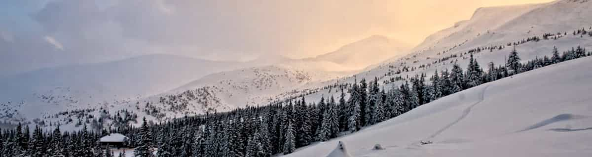
Bischofswiesen/Götschen at 1094 m altitudine
Publicato da Snow-Forecast.com a: 7 am (ora locale) / 20 Apr 2024
Now
Saturday 20 | Sunday 21 | Monday 22 | Tuesday 23 | Wednesday 24 | Thursday 25 | Friday 26 | |||||||||||||||
AM | PM | notte | AM | PM | notte | AM | PM | notte | AM | PM | notte | AM | PM | notte | AM | PM | notte | AM | PM | notte | |
nevi cata leggera | nevi cata leggera | nevi cata leggera | nevi cata leggera | nevi cata leggera | nevi cata leggera | nevi cata leggera | nevi cata leggera | nevi cata leggera | nevi cata leggera | nevi cata leggera | nevi cata leggera | nevi cata leggera | nevi cata leggera | nevi cata leggera | nevi cata leggera | nevi cata leggera | rovescio di neve | poche nuvole | pioggia leggera | rovescio di pioggia | |
km/h | |||||||||||||||||||||
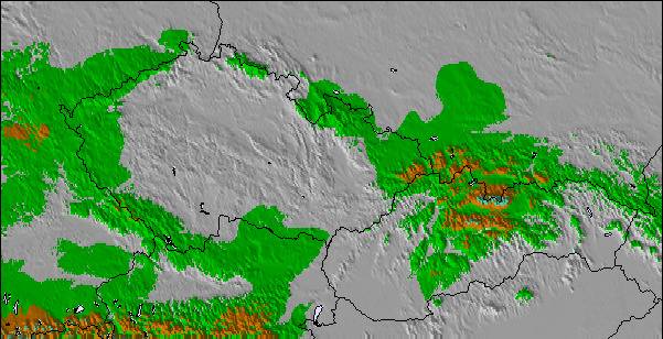
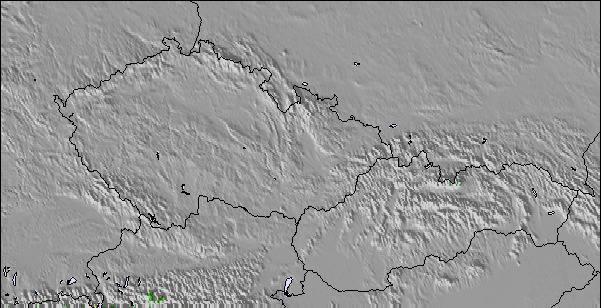
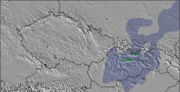
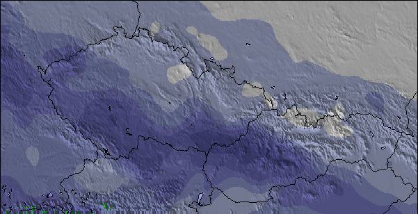
Snow map |  |  |  |  |  |  |  | ||||||||||||||
cm | 3 | 2.0 | 3 | — | 1.0 | 2.0 | — | — | 2.0 | 1.0 | 1.0 | 2.0 | 2.0 | 2.0 | 1.0 | — | — | — | — | — | — |
mm | — | — | — | — | — | — | — | — | — | — | — | — | — | — | — | — | — | — | — | 2.0 | 1.0 |
max°C | -1 | 0 | -1 | 0 | 0 | -1 | -1 | 1 | 0 | -1 | -1 | -1 | -1 | 0 | -1 | 0 | 2 | 2 | 3 | 5 | 4 |
min°C | -1 | 0 | -4 | -2 | 0 | -3 | -2 | 0 | -2 | -2 | -1 | -3 | -2 | 0 | -2 | -2 | 1 | 0 | 1 | 5 | 2 |
chill°C | -6 | -4 | -6 | -4 | -2 | -3 | -2 | -2 | -2 | -2 | -4 | -6 | -5 | -3 | -2 | -2 | 0 | -2 | 0 | 5 | 2 |
Umido.% | 96 | 87 | 98 | 90 | 99 | 98 | 91 | 87 | 97 | 95 | 93 | 98 | 94 | 97 | 98 | 91 | 90 | 87 | 90 | 93 | 89 |
Zero termico (m) | 1000 | 1100 | 600 | 1050 | 1050 | 600 | 1000 | 1200 | 800 | 950 | 1000 | 750 | 1000 | 1100 | 800 | 1100 | 1350 | 1100 | 1600 | 1800 | 1500 |
6:09 | — | — | 6:07 | — | — | 6:05 | — | — | 6:03 | — | — | 6:01 | — | — | 6:00 | — | — | 5:58 | — | — | |
— | — | 8:05 | — | — | 8:06 | — | — | 8:07 | — | — | 8:08 | — | — | 8:10 | — | — | 8:12 | — | — | 8:13 | |
Prossimi 0-3 giorni riassunto meteo
Una moderata caduta di neve, concentrandosi maggiormente Sabato mattina. Condizioni di gelo e disgelo (max 1°C Lunedì pomeriggio, min -4°C Sabato notte). Vento sarà generalmente leggero.
Prossimi 4-6 giorni riassunto meteo
Una leggera copertura di neve nuova, che ancora cade Mercoledì pomeriggio. Condizioni di gelo e disgelo (max 2°C Giovedì pomeriggio, min -3°C Martedì notte). Vento sarà generalmente leggero.
Popular Bischofswiesen/Götschen Pages
Radar Neve
Invia un reportGli ultimi report della neve vicino a Bischofswiesen/Götschen:
37 km Assente da Bischofswiesen/Götschen
1 hour fa
Rain reported from Bischofshofen at 550 metres elevation 6 kms N of St Johann-Alpendorf but it is forecast cold enough for snow at higher elevations in the ski area da St Johann-Alpendorf
42 km Assente da Bischofswiesen/Götschen
1 hour faRain reported from Rauris at 917 metres elevation 6 kms ESE of Kaprun/Maiskogel but it is forecast cold enough for snow at higher elevations in the ski area da Kaprun/Maiskogel
38 km Assente da Bischofswiesen/Götschen
3 hour faRain reported from Saalbach at 981 metres elevation only 3 kms NE of Saalbach Hinterglemm but it is forecast cold enough for snow at the ski area da Saalbach Hinterglemm
Bischofswiesen/Götschen Condizioni della neve
| La profondità maggiore della neve é: | 0 cm |
|---|---|
| La profondità minore della neve é: | 0 cm |
| Fresh snowfall depth: | 12 cm |
| Quando ha nevicato l'ultima volta? | 19 Apr 2024 |
Altre località in Germany stanno segnalando: neve fresca (3) / buona pista (3)
Snow-Forecast Partner Offers
Show your business here
Storia della neve
Settimana 3 di April ha in media:
0.1 | Giorni neve fresca Neve fresca, prevalentemente soleggiato, vento debole. |
|---|---|
0.4 | Giorni neve fresca Fresh snow, limited sun, any wind. |
0.1 | Giorni Bluebird Neve media, prevalentemente soleggiato, vento debole. |

Altre località in Germany stanno segnalando: neve fresca (3) / buona pista (3)
La tabella sopra da le previsioni meteo per Bischofswiesen/Götschen a specifiche altezze 1094 m. I nostri sofisticati modelli meteo ci consentono di fornire previsioni neve per la vetta, l'area intermedia e a valle delle stazioni sciistiche di Bischofswiesen/Götschen. Per accedere alle previsioni meteo ad altre altezze, per spostarti usa tab sopra la tabella. Per una visione meteo piu' ampia , controlla la mappa meteo di Germany.
Clicca qui per leggere ulteriori informazioni sullo zero termico e il nostro sistema di prevedere le temperature.
Il nome della localita' è scritto anche come Bischofswiesen-Goetschen.
Recensioni dei visitatori di Bischofswiesen/Götschen
- Andy da Russia scrive:
Pretty area but small and when half of it is closed for sports events it becomes simply much too small. Sadly, they often close it and tend to forget to inform about it on their website. You learn when you come and then the day is wasted.
Recensioni dei visitatori di Bischofswiesen/Götschen
Andy da Russia scrive:
Pretty area but small and when half of it is closed for sports events it becomes simply much too small. Sadly, they often close it and tend to forget to inform about it on their website. You learn when you come and then the day is wasted.
Clicca qui per inviare la tua recensione di Bischofswiesen/Götschen
Gratis Snow-Forecast.com weather widget per il tho sito
Il Bischofswiesen/Götschen widget meteo qui sotto è disponibile per essere incorporato su siti Web esterni a titolo gratuito. Esso fornisce un riepilogo giornaliero delle nostre Bischofswiesen/Götschen previsioni meteo neve e dati meteo. Basta andare alla pagina di configurazione e seguire 3 semplici passi per prendere il codice html personalizzato ed incollarlo nel tuo sito. È possibile scegliere l'elevazione di previsione di neve (vetta, metà o piede della montagna) e l'unità metrica/imperiale per le previsioni meteo neve adeguata al proprio sito Web Clicca qui per ottenere il codice
Guarda previsioni meteo neve dettagliate per Bischofswiesen/Götschen a:
snow-forecast.com

 Nearest